PaceGive it three to five days for the main camps, a week or more for Ras Dashen. Walk slowly above 3,500 m, drink plenty and expect nights below freezing. Other plates in this section.
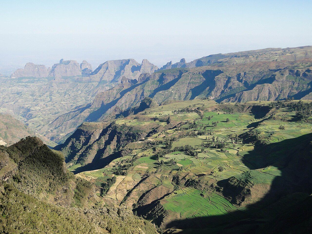
The Simien Mountains rise north-east of Gondar as a high, rolling plateau of grass, heather and giant lobelia, cut on its northern side by an escarpment that drops for a kilometre or more in sheer cliffs and pinnacles to the lowlands below. Erosion has carved the land into towers, buttresses and deep valleys, and on clear mornings you can look out across what seems like half of northern Ethiopia. The national park was among the first places inscribed on the UNESCO World Heritage List, in 1978, and it is the best known trekking area in the country.
The escarpment and its wildlife
Most of the walking follows the edge of the escarpment, and the views are the main reason to come. The plateau sits mostly between about 3,000 and 4,000 metres, with the highest summits above that, and the air is thin and clear. Afternoon cloud often boils up from the lowlands and spills over the edge, and mornings are usually the clearest time of day.
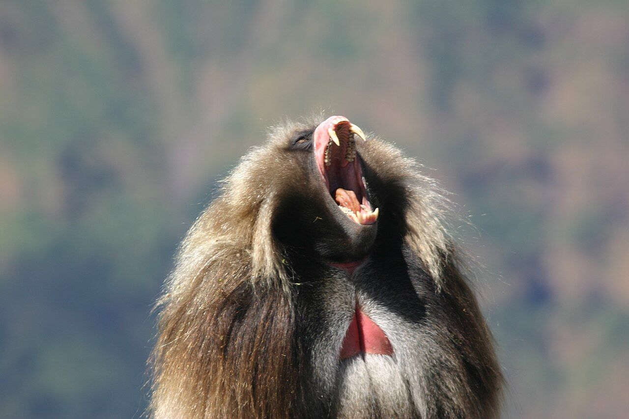
Gelada are the animals you will see most. These grass-eating primates, found only in the Ethiopian highlands, live in large groups that spread out over the meadows near the cliff edge by day and climb down to sleep on the ledges at night. They are used to people and you can sit quietly near a group and watch them graze, groom and argue. Keep a few metres away, do not feed them and follow your scout's lead.
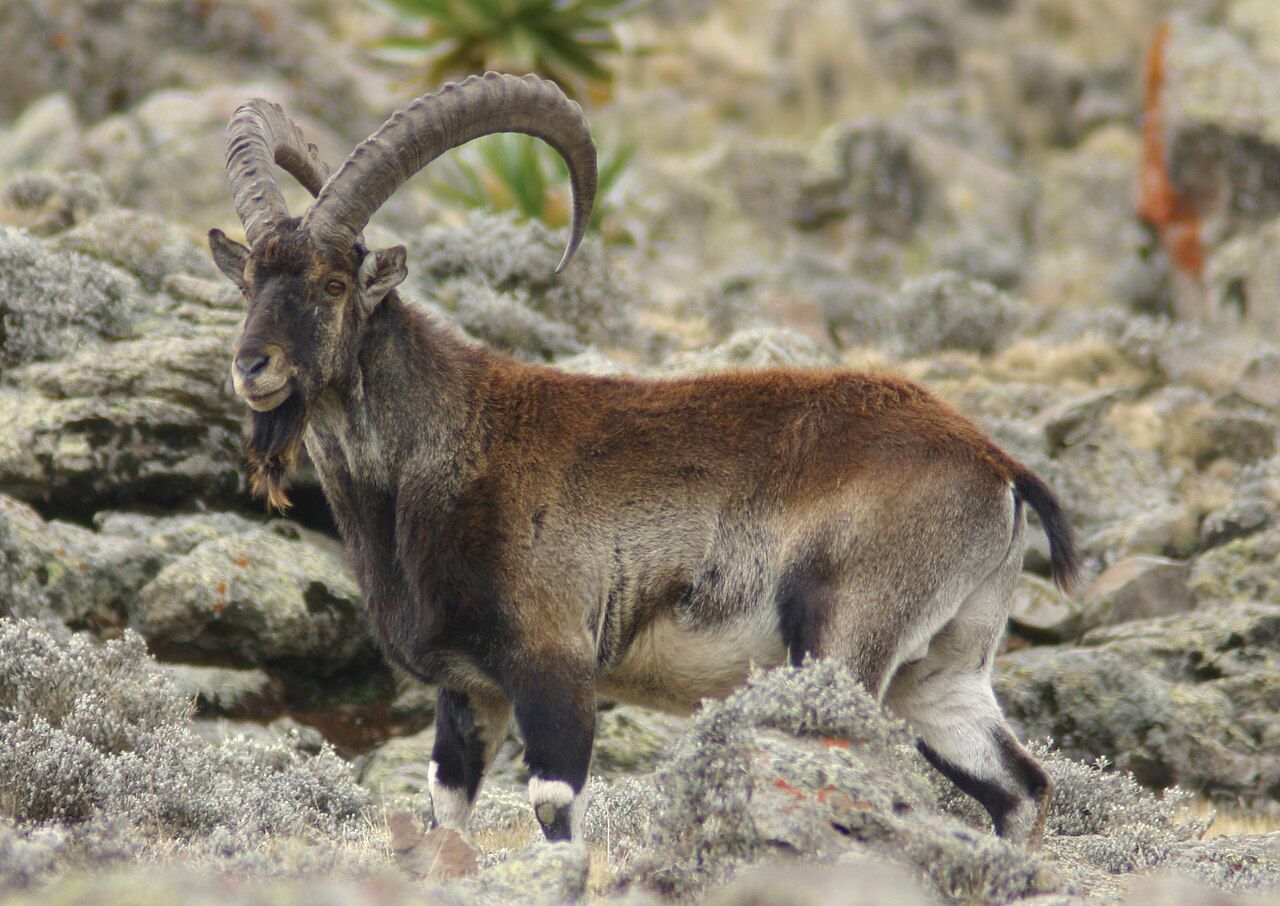
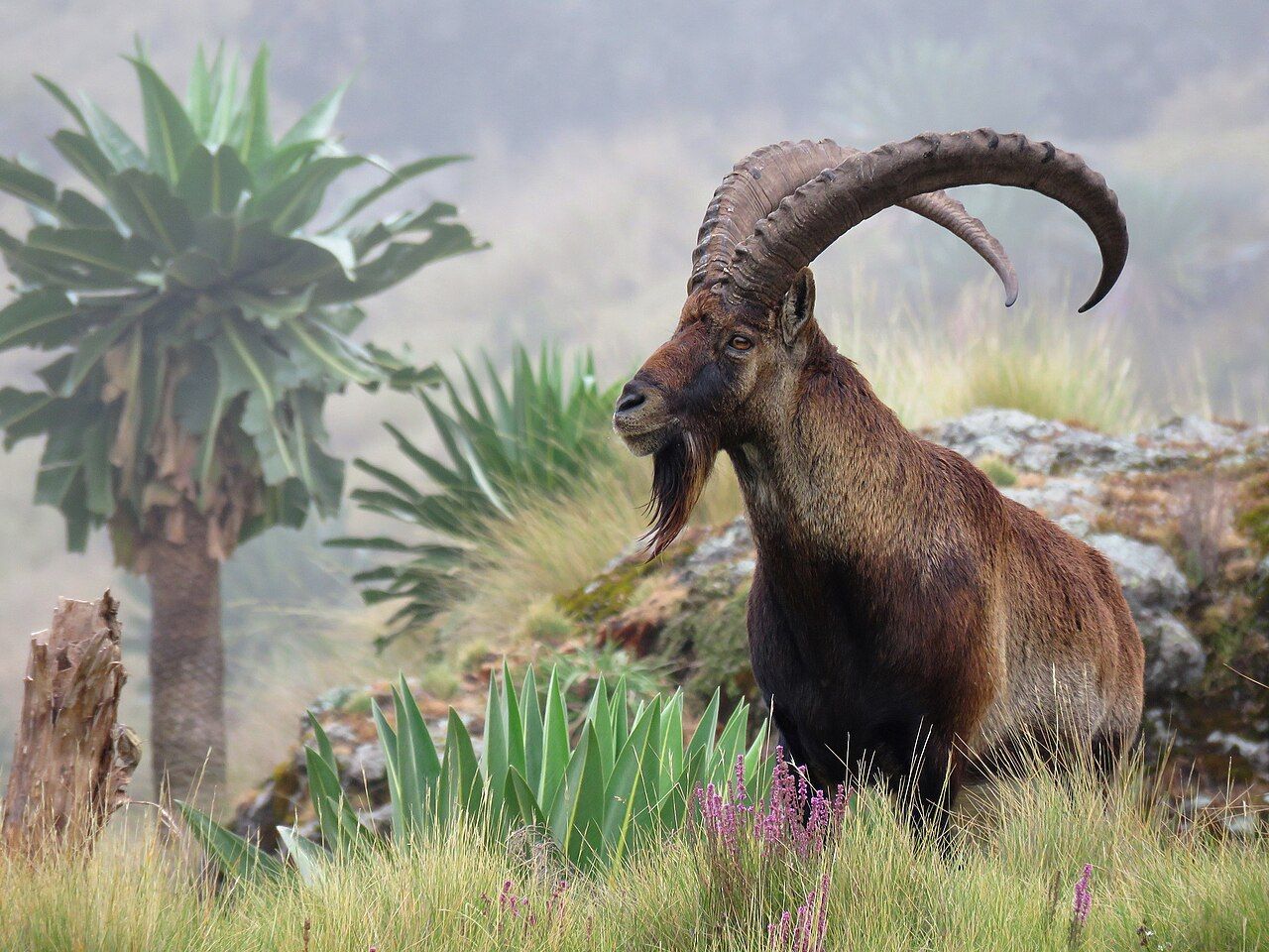
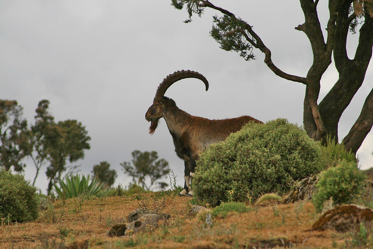
The walia ibex is rarer and found nowhere else in the world. Its numbers fell to a few hundred in the past and have recovered with protection. You are most likely to see it on the cliffs around Chenek and further east, picking its way along impossible ledges. Ethiopian wolves live on the higher ground in small numbers and are seen only occasionally, and lammergeiers, the bone-breaking vultures, glide along the cliff face.
The plants change as you climb. Lower slopes are farmed and grazed, with patches of eucalyptus planted around villages. Higher up come forests of tree heather hung with grey lichen, then open Afro-alpine grassland where giant lobelias stand like spiked columns and small everlasting flowers cover the ground after the rains. Much of this vegetation grows slowly in the cold, which is one reason the park asks you to keep to the paths and not to cut wood for fires.
Sankaber, Geech and Chenek
The classic route links a series of camps along the escarpment, each a day's walk apart, with a road running through the park that allows shorter trips or vehicle support. Sankaber, the first camp, sits at around 3,200 metres on a narrow ridge, with views down both sides. The walk from there to Geech passes the Jinbar waterfall, which plunges off the plateau into a deep gorge, and the flow is best after the rains.
Geech, at around 3,600 metres, sits on open grassland near a village, and it is the base for the walk to Imet Gogo, a rocky promontory at close to 3,900 metres that many people consider the finest viewpoint in the park. Go for sunrise if you can manage the cold. From Geech the route continues to Chenek, also around 3,600 metres, a camp below a curving wall of cliffs where gelada are almost always around and walia ibex are often seen. Above Chenek, the summit of Bwahit, well above 4,000 metres, makes a good acclimatisation climb.
The walking is not technical, but the altitude makes every climb harder than it looks. The walking is not technical, but the altitude makes every climb harder than it looks. Walk slowly, drink a lot, and take a rest day if you have a headache that does not go away.
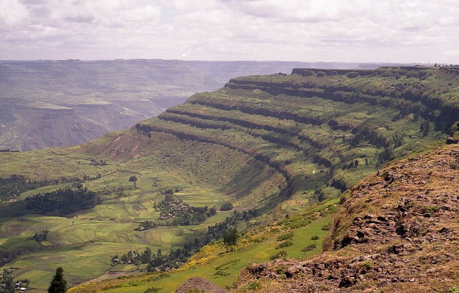 Plate 06 · Debre LibanosDebre Libanos and the edge of the Jemma gorge
Ras Dashen
Ras Dashen, at around 4,550 metres, is the highest mountain in Ethiopia and one of the highest in Africa. It lies east of the main escarpment route, beyond the deep valley of the Mesheha river, and climbing it adds several days to a trek: a long descent and climb out of the valley, a night at a village camp below the summit, and an early, cold start for the final climb over rocky ground. The top is a rocky outcrop rather than a dramatic peak, and the reward is the view and the satisfaction more than the summit itself. Plan for at least a week from Debark if Ras Dashen is your goal.
Scouts, park rules and logistics
All treks start at the park headquarters at Debark, a few hours' drive north of Gondar, where you pay park fees and arrange a scout, who is required to accompany visitors in the park and usually carries a rifle. Many people also take a local guide, a cook and mules with a mule handler, all arranged through the park office or in Debark.
Camping is permitted only at the designated camps, some of which have basic huts or shelters. Take all your rubbish out with you, keep to paths near the cliff edge and never approach the drop to get a better photograph. The road through the park has improved, so it is possible to drive to Sankaber, Geech or Chenek and walk only part of the way, which is a good option if you have limited time.
If you have only a day, it is possible to drive in from Debark to Sankaber or Geech, walk a section of the escarpment and return the same evening, though you lose the sunrises and sunsets that make the camps worth the cold. Two or three nights inside the park is a far better use of the long drive from the lowlands.
The communities in and around the park have farmed and grazed the area for generations, and you will pass through villages and fields. Ask before you photograph anyone, and respect fields and crops along the path.
Seasons, cold and kit
The main rains fall roughly from June to September, when paths are muddy and clouds often hide the view, though the land is at its greenest. September and October bring flowers and clear views as the rains end. From October to March the weather is mostly dry and bright, but nights at Geech and Chenek often fall below freezing, and frost on the tent is common. Daytime sun at this altitude is intense.
Bring a warm sleeping bag rated for well below zero, a down jacket, a hat and gloves, sturdy boots, sun cream and sunglasses, and a way to treat water. Many trekkers rent camping gear in Debark or Gondar; check its condition before you leave.
The park lies in the Amhara region, which has seen armed conflict in recent years, and conditions on the roads to Debark have at times changed quickly. The Bale Mountains in the south offer a different kind of high country, and the circuit notes show how to fit the Simien into a northern route.
Images on this page: Bernard Gagnon (CC BY-SA 3.0); Leonard A. Floyd (CC0 1.0); Marius Burger (CC0 1.0); Leonard A. Floyd (CC0 1.0); Manuel Schwarz (CC BY 4.0); Ron Knight from Seaford, East Sussex, United Kingdom (CC BY 2.0).


